Ffiniau Hanesyddol Cymru Historical Boundaries
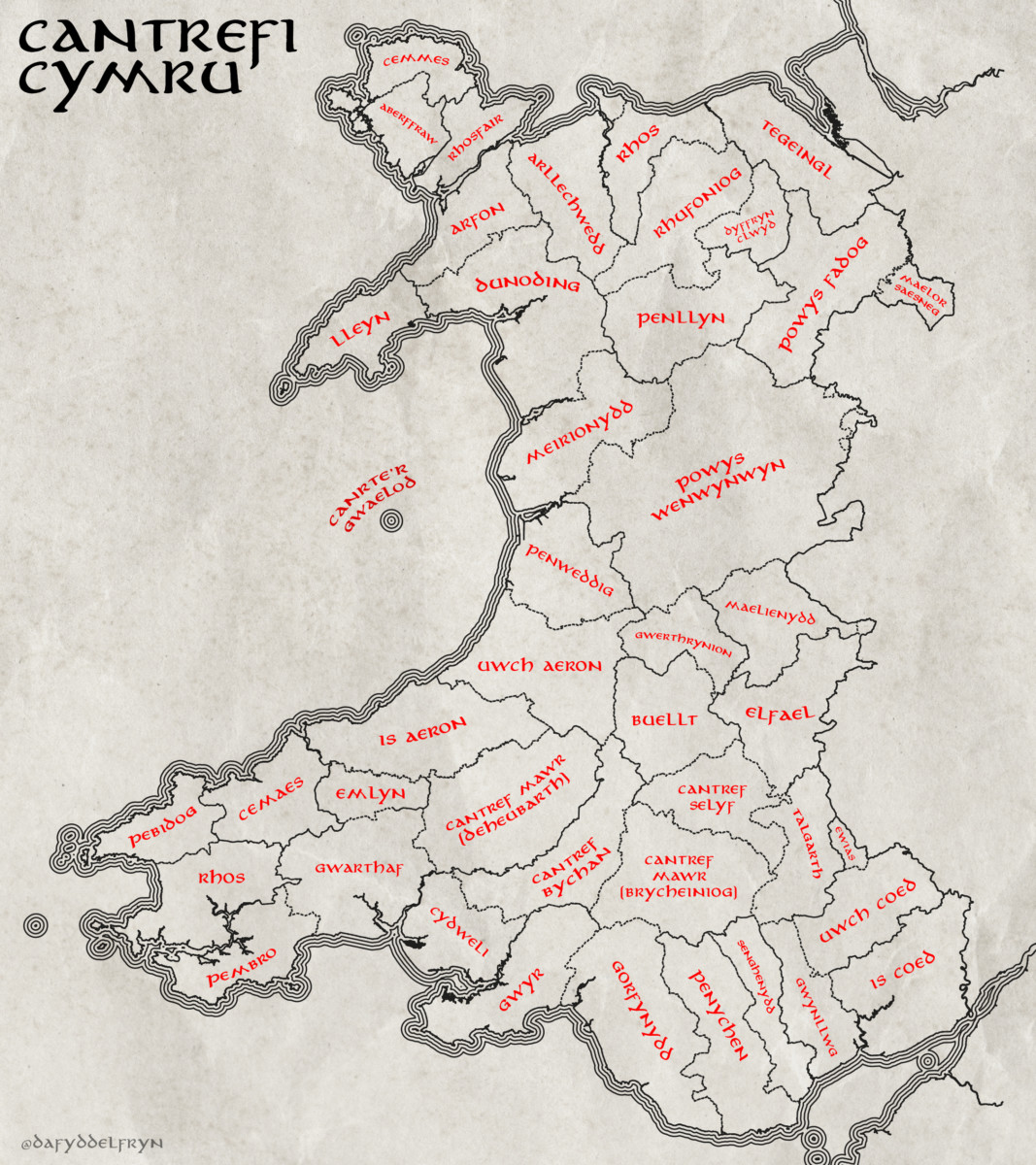
Yn ddiweddar, dwi wedi bod yn gweithio ar greu fapiau yn dangos yr hen ffiniau yng Nghymru, yn bennaf y cantrefi a cymydau.
Yn ffodus iawn, mae’r Comisiwn Brenhinol Henebion Cymru wedi gwneud y gwaith caled o greu fersiwn digidol o’r data daearyddol yn barod (linc).
Mae’r mapiau isod wedi eu creu hefo’r data yma – ac wedi ei ysbrydoli gan fapiau o lyfrau Tolkien. Cliciwch ar y mapiau, wedyn y botwm “i” yn y gwaelod i gael copi maint llawn.
I weld mwy o fanylion, mae fersiwn rhyngweithiol ar gael yma – Map Rhyngweithiol
Lately I’ve been working on mapping the old boundaries of Wales, namely the Cantrefi and cymydau (commotes).
Luckily for me, the Royal Commission on the Ancient and Historical Monuments of Wales already did the hard work of digitising the boundaries into a spatial data format that I could use (link).
The maps below were built using this data, with some inspiration from the maps found in the Tolkien books. Click on the maps, then click on the “i” button to get a high-resolution copy.
An interactive version of the data is also available here – Interactive Map


hwyl
Dafydd
Sorry to be a saesneg- my wife is South Welsh and has the O-Level- which dates us both! I can get the gist of written Welsh but can’t claim anything more than a smattering. Both very interested in Wales and mapping- and in my case cartography too.
What a fascinating collection of resources! I found it via someone posting your ‘drainage rivers of Wales’ on Facebook/Twitter, with no attribution. People were saying it was a fictitious map, and arguing at the level of ‘no river runs parallel to the Menai Strait’!
Luckily I could find your name on the map and hence found your blog and site.
I currently live near the Somerset Levels, and had fun when lidar data started being available creating animations of the local coast line for 1, 2, 3, … metre sea-level rising. Wish I had access to modern high-power GIS software and time to learn it. What do you use?
Do you have a high-res file of the river map? I’d happily pay to be able to load it in a graphics app and use colour-fill to click on a river-mouth and see the basin mapped out! The on-line version is too fuzzy- click on the Tawe ( our local river when in Wales) and it wrongly connects to other neighbouring catchments.
Diolch yn fawr am eich gwaith
Hi John
Thank you for your message
The rivers map was built using the OS opendata rivers dataset, which can be downloaded here – https://osdatahub.os.uk/downloads/open/OpenRivers
The data shows the centerlines of every river, so it doesn’t represent the true shape, juts location.
To get a better representation, you could try the OpenMapLocal or OpenMapDistrict datasets. They will better represent the true size/shape of the rivers
i use QGIS for the GIS work
hwyl
Dafydd